Great Himalayan National Park Conservation Area Belt:
A Living Corridor of Wilderness and Community
The Great Himalayan National Park Conservation Area Belt is not a single destination marked by monuments or viewpoints. It is a vast, layered ecological continuum where altitude replaces roads as the primary organizing force, and seasons dictate access more strictly than calendars. Spread across the western Himalayan ranges of Himachal Pradesh, this conservation belt represents one of India’s most intact mountain ecosystems—an interconnected landscape of alpine meadows, temperate forests, glacial valleys, and traditional villages that still function within ecological limits.
Unlike conventional protected areas that are perceived as isolated reserves, the Great Himalayan National Park Conservation Area Belt functions as a living corridor. It includes the core national park, buffer zones, wildlife sanctuaries, and human settlements that together sustain biodiversity and cultural continuity. Here, conservation is not abstract policy; it is practiced daily through regulated grazing, seasonal migration, forest use traditions, and adaptive livelihoods.
This travel narrative explores the conservation area belt as an experiential landscape rather than a checklist destination. It examines ecological structure, cultural interdependence, access realities, and responsible ways to engage with one of the most sensitive protected regions in the Himalaya. The focus remains on understanding, not consumption—on entering a conservation landscape without overwhelming it.
Destination Overview: Understanding the Conservation Area Belt
Geographical Extent and Structure
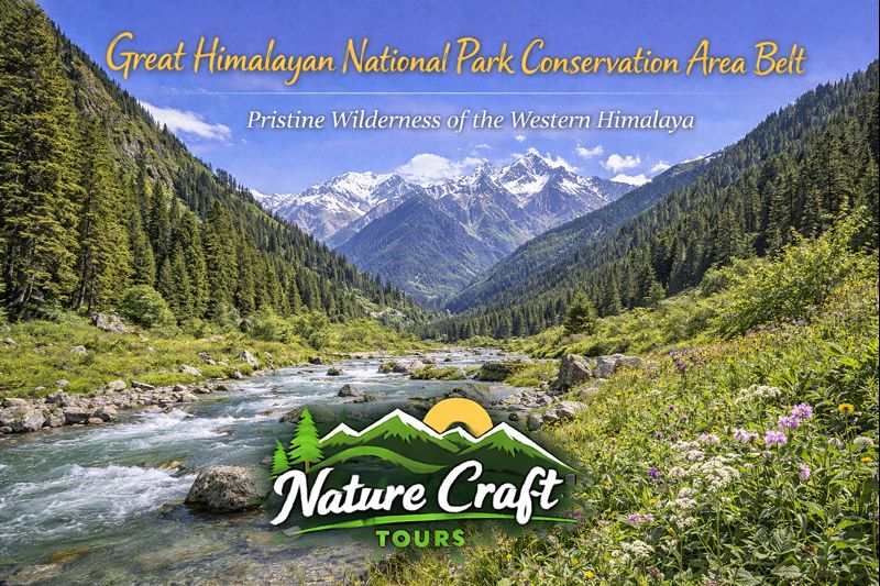
The Great Himalayan National Park Conservation Area Belt lies in the Kullu region of Himachal Pradesh, extending across high-altitude catchments of the Tirthan, Sainj, Jiwa Nal, and Parvati river systems. Elevations range dramatically—from around 1,500 meters in lower valleys to over 6,000 meters along snowbound ridges and peaks.
This vertical range creates a compressed ecological gradient where multiple vegetation zones coexist within relatively short horizontal distances. Subtropical forests transition into temperate broadleaf zones, conifer forests, alpine scrub, and finally high alpine meadows and glaciers. The belt’s ecological value lies in this continuity.
Core, Buffer, and Transition Zones
The conservation area is structured around a strictly protected core zone, surrounded by buffer areas and multiple eco-sensitive transition zones. While the core remains largely off-limits to general visitation, buffer and transition zones allow controlled access, trekking, and community-based tourism under regulation.
This zoning model recognizes that long-term conservation depends on coexistence rather than exclusion.
Ecological Significance of the Belt
A Biodiversity Stronghold
The conservation belt is home to an extraordinary range of flora and fauna, many of which are endemic or endangered. Species such as the snow leopard, Himalayan brown bear, musk deer, Himalayan monal, and western tragopan rely on intact habitat corridors across altitude zones.
Plant diversity is equally significant. Medicinal herbs, alpine flowers, and old-growth forest species form complex ecological relationships that remain poorly documented due to difficult terrain and limited access.
River Origins and Downstream Dependence
The region functions as a critical water tower for lower Himalayan and plains ecosystems. Snowmelt and glacial runoff from the conservation belt feed tributaries that sustain agriculture and settlements far downstream. Any disruption here has cascading consequences beyond the mountains.
Cultural Landscape Within the Conservation Belt
Traditional Villages and Forest Dependency
Scattered along the edges of the conservation area are villages whose histories predate modern conservation frameworks. Communities in valleys such as Tirthan and Sainj traditionally practiced seasonal grazing, selective forest use, and crop rotation adapted to altitude and climate.
While regulations have altered certain practices, many cultural patterns persist, shaping how people interact with the protected landscape today.
Sacred Groves and Local Deities
Spiritual belief systems play a subtle but powerful role in conservation. Sacred forests, restricted slopes, and deity-associated zones have historically limited exploitation, inadvertently preserving biodiversity. These cultural boundaries often align closely with modern ecological priorities.
Historical Evolution of Conservation in the Region
From Resource Landscape to Protected Area
Before formal protection, the region functioned as a shared resource landscape. With increasing pressure from logging, grazing, and external extraction during the mid-20th century, ecological stress became visible. The establishment of protected status marked a shift from extraction to preservation.
However, this transition was not without conflict. Conservation policies reshaped livelihoods, requiring gradual adaptation and negotiation.
UNESCO Recognition and Global Significance
International recognition reinforced the region’s global ecological value. It also introduced new responsibilities—balancing global conservation standards with local realities.
Best Time and Season to Explore the Conservation Belt
Spring to Early Summer (April to June)
Lower valleys emerge from winter, forests bloom, and snow remains visible at higher elevations. This period offers excellent conditions for nature walks, birding, and gradual altitude exposure.
Peak Summer (July to September)
High-altitude access opens during this period. Alpine meadows come alive with seasonal flora, and trekking routes become feasible. Weather remains relatively stable, though rainfall can occur in lower zones.
Autumn (October to Early November)
Clear skies and sharp visibility define autumn. Wildlife sightings increase as animals descend. Temperatures drop quickly, signaling the end of the access season.
Winter (Late November to March)
Heavy snowfall restricts access to higher zones. Conservation activity continues through monitoring and research rather than travel.
Ideal Travel Duration
Exploring the conservation area belt meaningfully requires time. A minimum of five to seven days allows engagement with one valley and its surrounding buffer zones. Extended itineraries of ten to twelve days enable deeper immersion across multiple zones.
Short visits risk reducing the experience to surface impressions without understanding ecological context.
Route and Accessibility
Approach to the Conservation Belt
Access to the conservation area typically begins from valley towns that serve as logistical bases. Roads penetrate only up to certain points; beyond that, movement is primarily on foot. This limited accessibility protects ecological integrity while shaping travel pace.
As with other ecosystem-driven journeys—whether navigating tidal forests during a Sundarban Trip or entering high-altitude wilderness—the approach itself prepares the traveler mentally and physically.
Movement Within the Belt
Movement is regulated through designated trails and entry protocols. Walking remains the dominant mode of exploration, reinforcing low-impact engagement.
Key Attractions and Experiential Highlights
Valley-Based Nature Zones
Lower valleys offer forest walks, river corridors, and bird habitats. These zones provide accessible entry points for understanding ecological layering.
Alpine Meadows and High Routes
Seasonal meadows above the tree line represent the most dramatic landscapes of the belt. These areas are accessible only during short windows and require careful planning.
Wildlife Observation Zones
Certain buffer areas are known for wildlife presence, though sightings depend on patience rather than predictability. Observation emphasizes distance and non-intrusion.
Practical Insights for Responsible Travelers
Acclimatization and Physical Preparedness
Altitude variation is significant. Gradual ascent, hydration, and rest days are essential to avoid altitude-related issues.
Environmental Discipline
All non-biodegradable waste must be carried out. Trails should not be widened, and flora must not be disturbed. Even small actions accumulate impact in slow-regenerating ecosystems.
Cultural Sensitivity
Villages within the conservation belt are not tourist exhibits. Photography, interaction, and movement should follow local norms and consent.
Seasonal Awareness
Weather and access can change rapidly. Flexibility and contingency planning are integral to travel here.
The Conservation Belt in the Context of Conscious Travel
The Great Himalayan National Park Conservation Area Belt represents a travel philosophy where restraint is central. Its appeal aligns with journeys that respect ecological thresholds, similar in intent to carefully structured nature-based experiences such as the Best Sundarban Tour Package, where environment determines pace, access, and behavior.
A Landscape That Teaches Limits
The Great Himalayan National Park Conservation Area Belt is not designed to impress through spectacle alone. Its power lies in scale, continuity, and restraint. It teaches that conservation is not about locking landscapes away, but about redefining how humans move through them.
For travelers willing to listen, slow down, and adapt, this conservation belt offers more than scenery. It offers perspective—on ecological interdependence, cultural resilience, and the necessity of limits in a fragile world. To walk here is to participate, briefly and humbly, in a system far older and far more complex than any itinerary.